
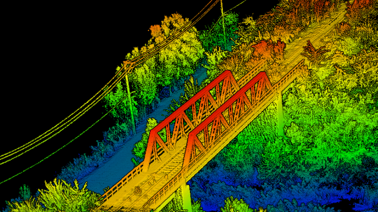
Farada Group provides 3D mapping, LiDAR and photogrammetric mapping services using G1 unmanned platform equipped with dedicated optoelectronic systems using RTK / PPK GNSS processing.
The technology used allows to extract a wide range of products from aerial photos, including:
- DEM / DTM / DSM surface models
- Orthophotomaps (geographically corrected aerial photos)
- 3D building models
- Contour maps
- Planimetric data (road edges, heights, signs, traces of buildings, etc.)
- Volumetric data
The use of aerial images with high resolution allows you to generate a range of products, such as classified point clouds, digital terrain models, digital surface models and high-resolution orthophotos GNSS.
The use of LiDAR technology and photogrammetry with the use of unmanned platforms significantly improves the efficiency of this type of operation. The costs of use are incomparably lower compared to the costs of using traditional means – manned. Farada Group’s solutions are dedicated in particular to the following goals:
- Management of forest crops and their planning
- Management, planning and monitoring of agricultural crops
- Flood modeling
- Modeling of pollutants
- Mapping and cartography
- Town planning
- Planning of communication networks
- Geology
- Shoreline management
- Transport planning
- Search for deposits (e.g. oil and gas)
- Quarries and minerals (volumetry and exploration)
- Archeology
- Planning of the cellular network
- Planning of transmission networks